Project Overview
Overview
NOTE : REALTIME GPS IS DISABLED IN SCREESHOT FOR SECURITY PURPOSE.
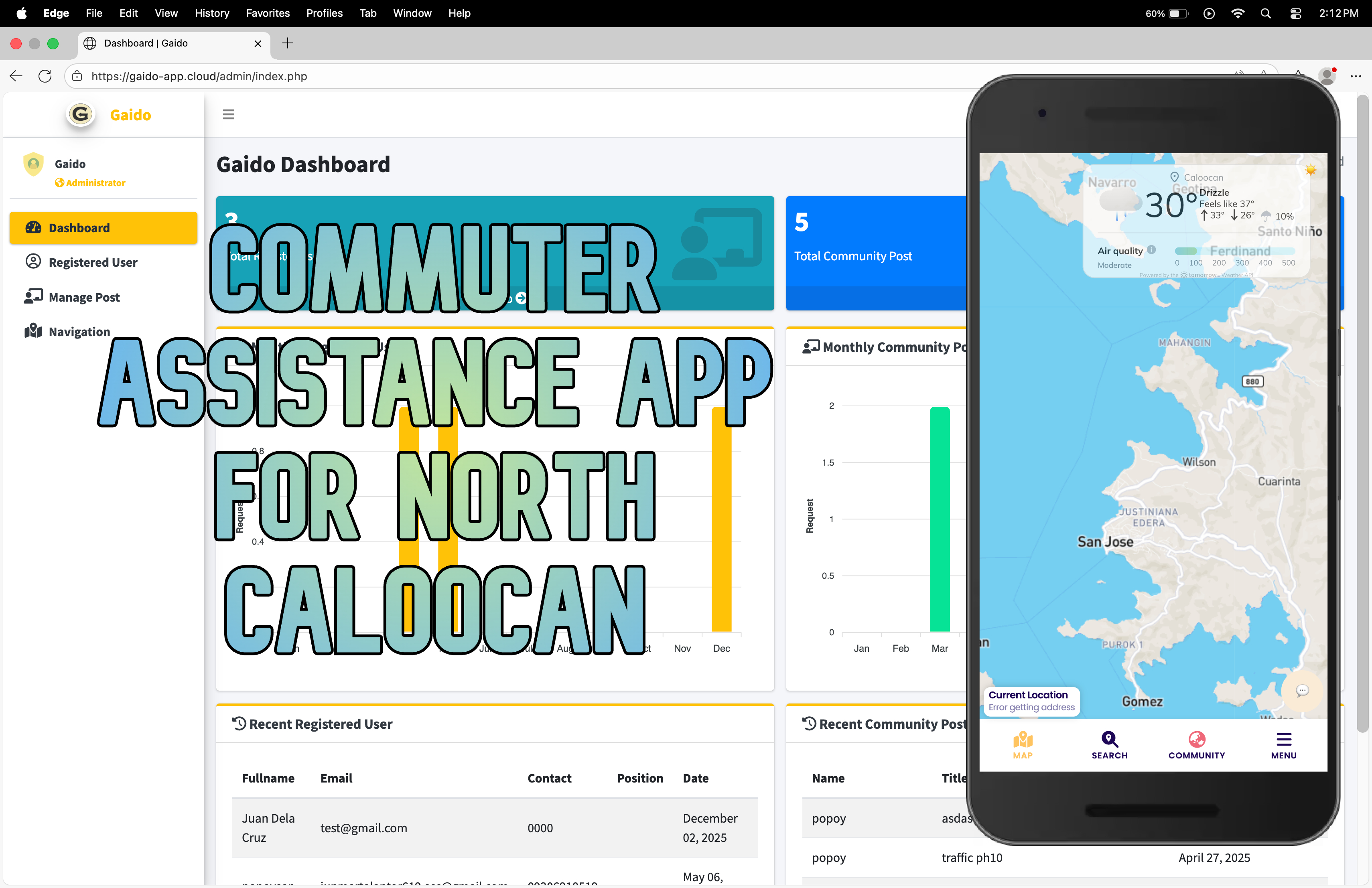
This mobile application is a community-driven platform designed specifically to enhance the daily commuting experience for residents and travelers in North Caloocan. By integrating both system-generated data and real-time user contributions, the app empowers commuters with up-to-date information on traffic conditions, accidents, flooding, and other route disruptions. It serves as a digital companion for public transport users and private vehicle owners alike, helping them make informed decisions to save time, avoid hazards, and navigate the city more efficiently.
Core Features & Functionality
Real-Time Route Alerts
Provides instant notifications on traffic congestion, road accidents, and flooding along major routes in North Caloocan.
Uses traffic APIs and sensor data to deliver system-generated updates.
User-Generated Content Hub
Allows commuters to post live updates, photos, and comments about current road conditions.
Fosters a collaborative environment where users can report issues, verify information, and help each other.
Public Transport Information
Displays schedules, routes, and estimated fares for jeepneys, buses, tricycles, and other public transportation options.
Helps users plan their trips and anticipate waiting times.
Incident Reporting & Verification
Users can report accidents, floods, roadblocks, and other emergencies.
The app includes a moderation and verification system to ensure information reliability, though it does not guarantee 100% accuracy.
Community-Driven Insights
Encourages interaction through upvoting, commenting, and sharing of posts.
Builds a sense of community among commuters who share common routes and challenges.
Data for Urban Planning
Aggregates anonymized commuting data to provide insights to government agencies and urban planners.
Helps identify traffic patterns, recurring problem areas, and opportunities for infrastructure improvement.
Scope & Limitations
Geographic Coverage: Focused exclusively on North Caloocan. Does not extend to smaller cities or regions outside the metro area.
Functionality Boundaries:
Does not include GPS turn-by-turn navigation.
Does not offer ride-hailing or booking services.
Does not directly manage traffic systems.
Data Reliability: While efforts are made to verify user posts, the app cannot ensure absolute accuracy of all shared information.
Objectives
General Objective
To develop a mobile application that provides real-time route information to enhance the commuting experience in North Caloocan.
Specific Objectives
To design a system that delivers real-time updates on traffic, accidents, and flooding.
To implement a user-generated content feature for sharing on-the-ground information.
To evaluate the app’s effectiveness in reducing commute times and improving safety.
To foster a collaborative community platform for commuters.
To provide actionable insights to government and urban planners for better transport planning.
Target Users
Daily commuters in North Caloocan using public or private transport.
Students, office workers, delivery personnel, and local drivers.
Government transportation agencies and urban development planners.
Why This App Matters
Commuting in urban areas like North Caloocan can be unpredictable and stressful due to sudden traffic changes, weather-related disruptions, and lack of real-time information. This app bridges the information gap by leveraging technology and community input to create a responsive, reliable, and user-centric tool. It not only helps individual commuters but also contributes to smarter city planning and safer roads for everyone.
Visual Concept
The app interface is designed to be clean, intuitive, and map-centric, with color-coded alerts (e.g., red for heavy traffic, blue for flooding). Users can toggle between a live feed of community reports and a map view showing real-time conditions. Icons for reporting, viewing schedules, and accessing fare estimates are easily accessible from the bottom navigation bar.